Welcome to my Camera Section. If there are any pictures of you or yours that you do not wish to have on this page, please email me.
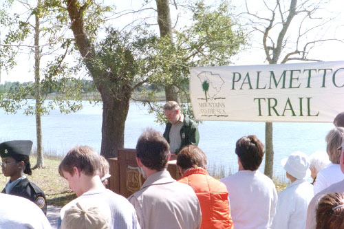
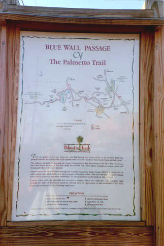
This is John speaking at the trail's grand opening ceremony. I guess it was a pretty big deal; they even had a senator speak. The part of the trail we worked on completed the Palmetto Trail. The Palmetto Trail is also called the "Mountains to the Sea Trail" because it runs the whole length of South Carolina, starting in the mountains at the western edge and ending at the ocean. However, until the opening of this last 5 mile leg of the trail, the Palmetto Trail ended at good ol' Hwy 17. Now the trail crosses Hwy 17 and ends at Buck Hall, a park area right up against the Intracostal Waterway.
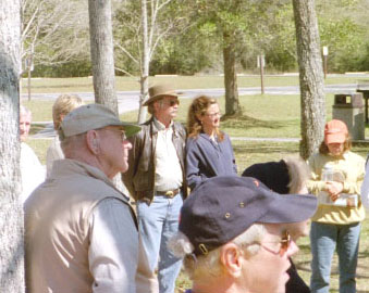
This is Jimmie and his wife, Josephine. They were two of the most hospitable, kind, friendly people I have ever met.
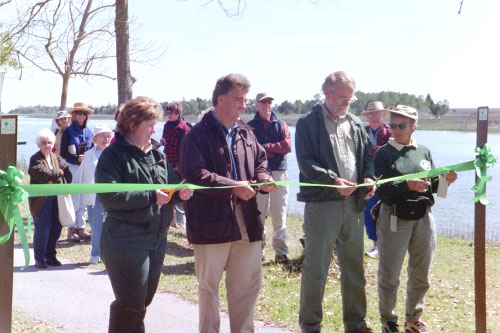
John assists in the ribbon cutting. The trail is open!
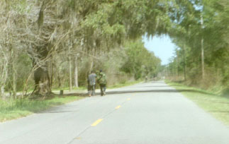
The following are views along the 5 mile trail that we worked on. We never really worked on every part of the 5 miles, so it was fun walking the whole length, noticing things here and there that we had worked on.
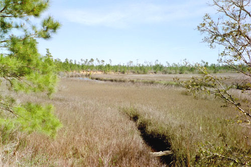
The beauty speaks for itself.
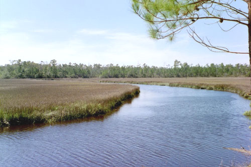
Awendaw Creek. The trail follows it for the first mile or two.

A sailboat gliding along the Intracostal Waterway.
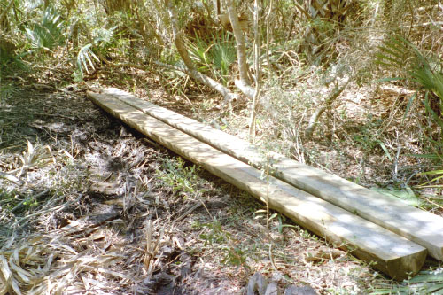
On Thursday, it rained. On Friday, we realized that bridges weren't built in a lot of places they should have been. So as a temporary solution, we hauled in these 20-foot long half-split telephone poles. They were extremely heavy and took 6 of us to move into place.
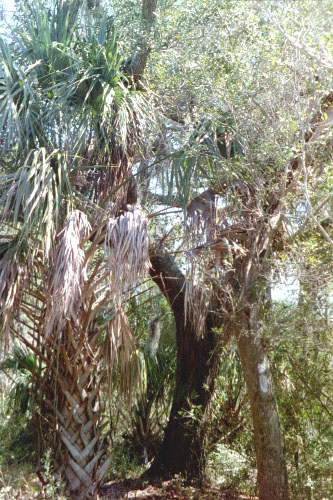
A palm tree next to an oak tree. What a wild mixture of plantlife.

Another view along the trail, this time more inland.

And this is the Intracostal Waterway next to Buck hall, the end of the trail. It took me just over 70 minutes to walk the 5-mile trail. I was bookin' because I still had to start my drive home that day. (Note the smoke in the background. Supposedly the National Forestry Service periodically does a controlled burn of about 500-1000 acres of the Francis Marion National Park to maintain the delicate ecosystem.)
This is, according to Nick, the oldest cemetary in McClellanville. Nick said his baby brother, who died shortly after birth, was buried there.
Gosh, darn kids in the road! Every time we drove to John's place, there was this one spot where a bunch of kids congregated. They rarely made room enough for your car (or huge pick-up) to pass through.

Before I left John's place for good, I wanted to get a picture of an alligator. I found this one sunnying himself in one of the ponds alongside the lane. He's about 2-3 feet long.

About 30 seconds after taking the above picture, I spotted a much larger alligator. Probably about 6 feet long; definitely big enough to fit me inside of him. He, too, was sunnying himself on the opposite side's bank. However, when I raised my camera to get a picture of him, he naturally bolted into the water. Now it makes sense that he went into the water for safety. However, being as he was on the opposite bank, heading into the water meant he moved in my general direction. This scared the bejeezus out of me and by the time the camera snapped the photo, I was already in mid-run. Thus this lovely picture not of a mammoth alligator, but of the sky.
After that little scare, I went back to the house, got my stuff packed up and headed out. I was the last to leave Palmetto. On the drive back I stopped to eat in a small town called Landon on the western edge of South Carolina. And what do you know, I saw a sign for the Palmetto Trail. This was the other end! I asked some locals about where it started and they pointed me to this sign. The sign pointed me into the back hills near there. So I started driving around looking for the beginning of the trail. It was dusk and the light was growing dim and here I am driving around these back hills where everyone lives in a mobile home and has goats in their front yard. It gave me the creeps. (Zoinks!) I never did find the beginning of the beginning, but I guess I found the middle of the beginning, so that'll have to be good enough.
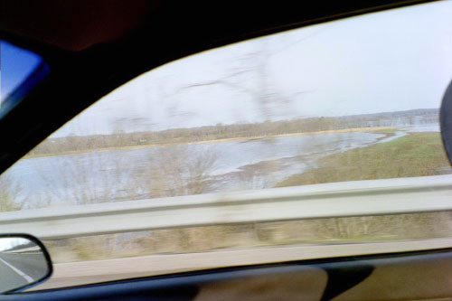
The next day I continued my drive and found that the Tennesse River had flooded its banks. I guess they had gotten tons of rain while I was in South Carolina.

This is a sign just outside of Iowa City that I've been meaning to take a picture of for some time. I don't know if it makes me feel safe to be in Iowa City or less safe when I'm somewhere else that isn't a "nuclear weapon free zone."
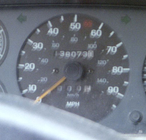
The end mileage on my car: 138073.8
Total mileage traversed: 2458 miles.
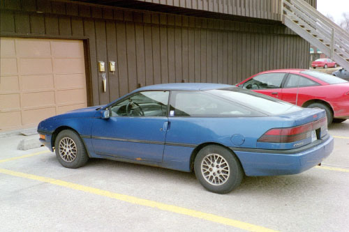
My lovely 1990 Ford Probe. What an excellent name for a car!
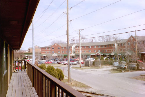
The view north out of the door to my apartment. (Read: A way to use up the second last picture on my camera.)
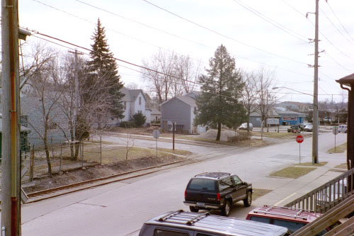
The view south out of the door to my apartment. (Read: A way to use up the last picture on my camera.)